If you ask a Texan where the "Guad" is, they’ll probably point you toward a tube rental shop in New Braunfels. They aren't wrong, but they’re only giving you a tiny slice of the map. Honestly, the Guadalupe River is a bit of a shapeshifter. It starts as a trickle in the rugged limestone of the Hill Country and ends as a massive delta spilling into the Gulf of Mexico.
So, where in Texas is the Guadalupe River exactly? It isn't just one spot. It’s a 230-mile journey that cuts through the heart of the state.
Most folks think of the river as just that party stretch near Gruene. In reality, the Guadalupe is the lifeblood of seven different counties. It moves from the high elevations of the Edwards Plateau down to the coastal prairies, changing its personality completely along the way.
The Headwaters: Where the Journey Begins
Everything starts in western Kerr County. This is the "Upper Guadalupe," and it’s a far cry from the wide, deep river you see further south.
The river is actually born from two separate forks—the North Fork and the South Fork. They converge near a tiny, picturesque town called Hunt. If you’ve never been to Hunt, it’s basically the definition of Hill Country charm. The water here is crystal clear, spring-fed, and bordered by massive, ancient bald cypress trees that have been standing since before Texas was even a republic.
From Hunt, the river meanders through:
- Kerrville: Where it widens out a bit thanks to small dams.
- Comfort: A historic town where the river starts to feel a bit more wild.
- Kendall County: This is where you’ll find the limestone bluffs that make the region famous.
The Famous Middle Stretch: Canyon Lake to New Braunfels
This is the section everyone talks about. If you’re looking for the "main event," this is it.
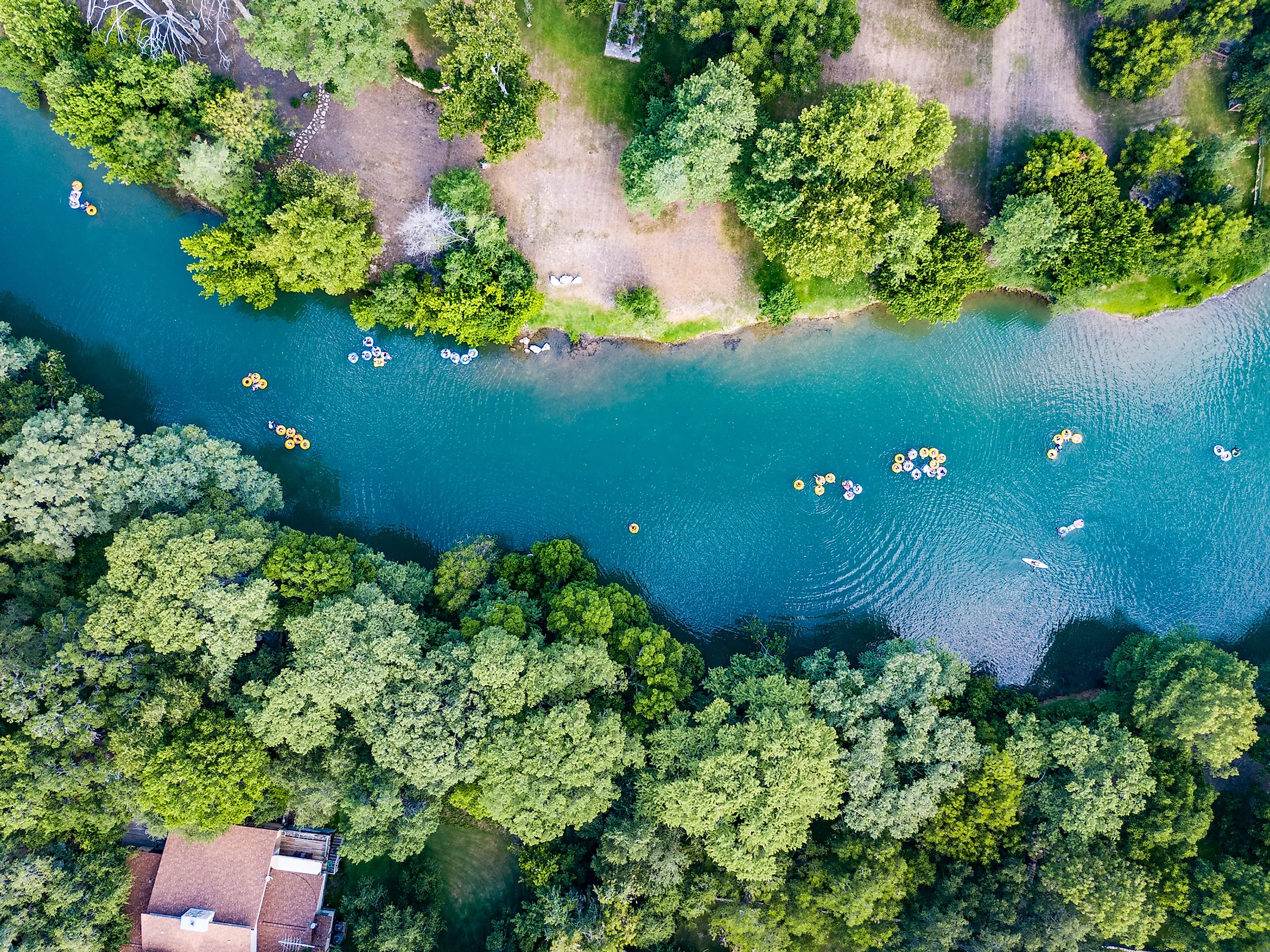
After leaving Kendall County, the river flows into Canyon Lake in Comal County. This isn't a natural lake; it was created by the U.S. Army Corps of Engineers back in the 60s to keep the river from flash-flooding the entire region. When the water leaves the Canyon Lake Dam, it enters what many consider the most beautiful—and crowded—stretch of water in Texas.
The "Horseshoe" and the "Chute" are legendary spots near New Braunfels and Gruene.
Why is it so popular? The dam releases cold water from the bottom of the lake. Even when it’s 105 degrees in August, the river stays a refreshing 60-something degrees. It’s sort of like a natural air conditioner. This stretch is also where the Guadalupe meets its famous siblings, the Comal River and the San Marcos River.
The Lower Guadalupe: Heading to the Coast
Once the river passes Seguin and Gonzales, the party vibes disappear. The limestone cliffs turn into rolling farmland and pecan groves.
By the time the river reaches Victoria, it’s a deep, brownish-green powerhouse. It doesn't look like a "Hill Country" river anymore. It looks like a coastal waterway. It eventually forms a border between Calhoun and Refugio counties before emptying into San Antonio Bay.
By the time it hits the Gulf, the river has dropped over 2,000 feet in elevation. It’s a long haul.
Finding the Best Access Points
Because so much of Texas is private land, you can't just jump in anywhere. You have to know the "public" spots.
- Guadalupe River State Park: Located near Spring Branch. It has four miles of river frontage and is perfect for families who want to skip the rowdy tubing crowds.
- Kerrville-Schreiner Park: A great spot for kayaking and seeing the "Upper" version of the river.
- Cypress Bend Park: A local favorite in New Braunfels that’s a bit more chill than the main tube chutes.
- Nichol’s Landing: This is the start of a popular paddling trail that offers some of the best cliff views in the state.
Safety and the "Flash Flood Alley" Reality
You’ve gotta be careful. The Guadalupe is beautiful, but it’s part of "Flash Flood Alley."
Because the terrain is so rocky, rain doesn't soak into the ground; it runs off into the river immediately. A storm twenty miles upstream can turn a lazy float into a dangerous situation in minutes. Experts like those at the Guadalupe-Blanco River Authority (GBRA) constantly monitor flow rates, measured in cubic feet per second (cfs).
If the flow is under 500 cfs, it's a lazy float. If it hits 1,000 cfs, you’re looking at serious whitewater. Always check the gauges before you go.
Nature and Wildlife: What to Watch For
The river is an ecological goldmine. It’s home to the Guadalupe Bass, the state fish of Texas. You won't find them anywhere else in the world.
Look up into the cypress trees and you might see a Water Moccasin sunning itself—don't panic, they usually want nothing to do with you. If you’re lucky, you’ll spot a Great Blue Heron or even a Bald Eagle. Down near the coast, keep your eyes peeled for alligators. They are rare in the Hill Country because the water is too cold, but in the Lower Guadalupe, they’re right at home.
Practical Steps for Your Trip
- Check the flow: Visit the USGS or GBRA websites to see the current cfs. Don't go if it's too high or too low (you’ll end up walking your tube over rocks).
- Know the "Can Ban": New Braunfels has strict rules about disposable containers. No cans, no glass. Pack a reusable jug.
- Respect private property: In Texas, the riverbed is generally public, but the banks are often private. Don't trespass.
- Sunscreen is non-negotiable: The Texas sun reflecting off the water will fry you faster than a corndog at the State Fair.
The Guadalupe River is more than just a place to drink a beer on a Saturday. It’s a complex, 230-mile ecosystem that defines the geography of Central Texas. Whether you’re fly fishing in the shadows of the Hunt headwaters or birdwatching in the coastal marshes of Victoria, you're experiencing a piece of Texas history that has been drawing people to its banks for over 12,000 years.